At 6.0, you get minor damage to buildings, just to give you some idea. At 6.5 structural damage and broken windows and some buildings become uninhabitable. If this hit 7.0, we've have homes destroyed, buildings flattened, bridges and dams affected (possibly breaking), and potentially regional devastation.
After about 50 seconds the shaking stopped. And then I found that the new GIS interface for USGS earthquakes is kinda sucky. You have to turn on the map layer to see the maps. That should be default on. People want maps. Duh! Do your jobs.
This wasn't the end of it either. In the Sea of Ohthotsk, in Eastern Coastal Siberia, there was an 8.3 quake, the size of the San Francisco quake in 1906, triggering tsunami warnings for the Pacific. It was strong enough it rang the planet like a bell, much like the 9.0 in Malaysia/Thailand which caused the massive tsunami the day after xmas several years ago, killing a quarter million people. This quake was extremely deep, at 600 km down, meaning it was in the Pacific Plate subsumed under the Asian plate. They've had 5.0 aftershocks. The quake was felt as far away as Moscow, several thousand miles away. Presumably this also means it was felt in Japan, Korea, China, and Alaska too. I feel bad for the folks in the Pacific islands running for high ground in the middle of the night. Tsunami warnings have got to be terrifying. I make a point of always living about the 400 foot mark about sea level. The kind of tsunami that can hit that high requires an asteroid strike, at which point you have bigger problems than drowning. Thank Larry Niven for that housing requirement. I read Lucifer's Hammer as a teenager.
During the night there was a short 15 second 4.9 aftershock, and a bunch of 2.5 aftershocks from the Greenville quake which woke me from a sound sleep. I suspect there will be more of those. Examination of the map shows there are dozens. Most too small to feel.
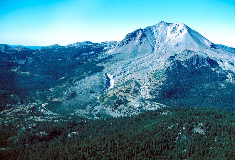 |
| Mount Lassen, eruption side |
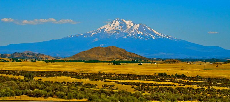 |
| Mount Lassen, stratovolcano. |
It would be interesting if Mount Lassen opted to start erupting again. It certainly could. It's in the Cascades volcanic complex, and it retains its active magma source, unlike volcanoes further south like Konocti and Mammoth Mountain. Those won't go off again. Lassen will. In a few hundred thousand years the triple junction for the Pacific and Juan de Fuca and North American plates will shift north, cutting off their magma supply just as its already cut off the supplies for the more southern volcanoes, including Castle Crags at Donner Pass, and the mountain just south of Big Pine on 395, and the across the Mojave Desert volcanoes down to Los Angeles. Non-geologists rarely notice these things, but I was trained for years to spot them and observe.
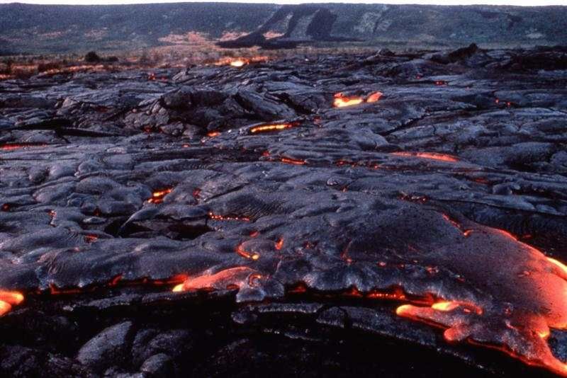
It would also be really interesting if Hat Creek Volcano erupted again, as those flood basalts would do a good job covering southern Oregon and Idaho as its already done several times. There's a bunch of volcanoes capable of that.
To be able to see that, with the convenience of local travel rather than having to deal with Hawaii, Alaska, or Kamchatka? Oh yeah. The lava flows of Table Mountain near Oroville are very interesting. Seeing those added to at the same time as poor maintenance and quakes destroy the bad levies? Indeed, California would become INTERESTING again. Kinda hard to argue about car exhaust emissions when volcanoes and spewing a planet worth of CO2 and steam and SO2 gases into the air in every day of eruptions. Which Mount Pinatubo did, btw. Al Gore conveniently ignored that in his nice movie.
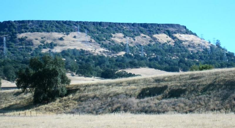 |
| Table Mountain, CA |
I wouldn't see this as a disaster, even if the lava flows are erasing a lot of human construction and probably some farmlands as well as burning down the trees and grasslands. Most of those areas are empty. That stuff will grow back. The magma is pretty slow so only really stupid people would die. As a Geologist, I'm a fan of evolution so Darwin Awards go where they belong. Just don't be one myself. Understanding the situation is a big help. I remember Mount Saint Helens eruption, and how it went from silent to erupting in about a week. There was little warning, really. You have to take the warnings you've got seriously. And keep a safe distance.
With this in the highlands and flooding in the lowlands, people might get the idea that California is unsafe. I never said it was safe. It has nice weather, but not enough water. It has mosquito borne illness, bubonic plague, vicious fires and snowstorms, and the surprise weather that hits our coasts is in the mountains 5-6 hours later, short enough you can get caught there and die of exposure. Being paranoid is a survival trait. Also, due to its remote canyons there's all sorts of odd people with cults and insanity living here. Caution is important. Idiots still ski into trees, which didn't used to be a problem until recently. Psychotic break? Probably. Driving too fast into corners, getting drunk in icy rivers on a hot day and freezing to death, surfing in shark infested waters: this is common. And people die. Are we better off without them? I suppose so. California is beautiful and dangerous and must be respected.
No comments:
Post a Comment