Got new tires on Dad's sports car. We took it out for a spin Sunday. It is a long way up 49 to Downieville. Hwy 49 goes and goes and goes before you reach North San Juan, looking little more than a slightly smoother country road. Then it goes and goes climbing even more passes and twisting narrow tree lined road before reaching the North Fork of the Yuba River and slowly climbing that. I was surprised to learn that Downieville, despite being famously icy in winter, is the same elevation as Nevada City: 2850 feet.
Downieville was a gold mining town. Like most, it has largely died back after the gold was extracted, but the North fork of the Yuba River flows through town and it's very pleasant in the summer. The water also provides trees and excellent trout fishing. And more recently, full suspension mountain bikes get carried up to the top in vans of tourists, then coast down 3000 feet on beautiful rocky trails. Ferrying tourists and bikes is a going trade for the locals, and it is mountain biking heaven. Having driven all the way up Highway 49, however, I can see a day when it will be easier and safer to come up from the East side over Yuba Pass rather than wind north up 49 through all that pot-growing hillbilly country. On our way through North San Juan, at 8:30 AM, there were several men still enjoying the prior night of drinking out front of the saloon. There's some of those places in Grass Valley and Nevada City, too, if you wondered. The hard core alcoholics glare at everybody going by. In a less pleasant, and even lower standard of living future I just can't see that road surviving very well without taxes to pay for it. And every desperate house you crawl past is another reminder of the gap between wealth and poverty. And if you're going up that road to play tourist, that's wealth. Safer to take the Eastern route out of Truckee or Grayeagle. Much safer. Folks there are already committed to tourism, with no delusions of industry, not like the Pot Growers fool themselves into.
And once you reach Downieville's East side by crossing the bridge, the road drastically improves, and you can flow up smooth pavement through Sierra City (which is a tiny town of 240 people), then up to wider and smoother and faster road to Bassets Junction, population 40, hang a left onto Gold Lake Road and see what was looming over your left shoulder: the Sierra Buttes.
They are pretty. They are the high point of the northernmost extent of the Sierra Nevada Mountains, about 7000 feet tall. There's a road up to 5700 feet, to Lower Sardine Lake, which has actual trout in it. I saw a couple fishermen with a stringer of 14 inch trout as they tiredly returned to their campsite on foot. Good for them.
About 10 miles north of the Buttes, the Mohawk Fault cuts off California's sub-plate mess from the North American Plate and the Cascade Range, which starts on the North Side of the faultline. Its active volcanos from there to Canada. For the geologically inclined, like me, this is a big deal. This is the northern tip of the Sierras, which runs all the way down to Tehachapi Pass, where the Garlock Fault cuts off their southern end and causes Death Valley, itself having some faults in the same pattern as the rest of Nevada's Basin and Range. The Buttes are carved by glaciers. The lakes are where the glacier was. It is all melted away, but it will come back if the snow is heavy enough not to completely melt in the summer. Forming glaciers isn't that hard to understand. It is all about accumulation that doesn't quite melt. If more accumulates than melts, it will eventually grow large enough to compact, and to move. And that's your glacier, right there.
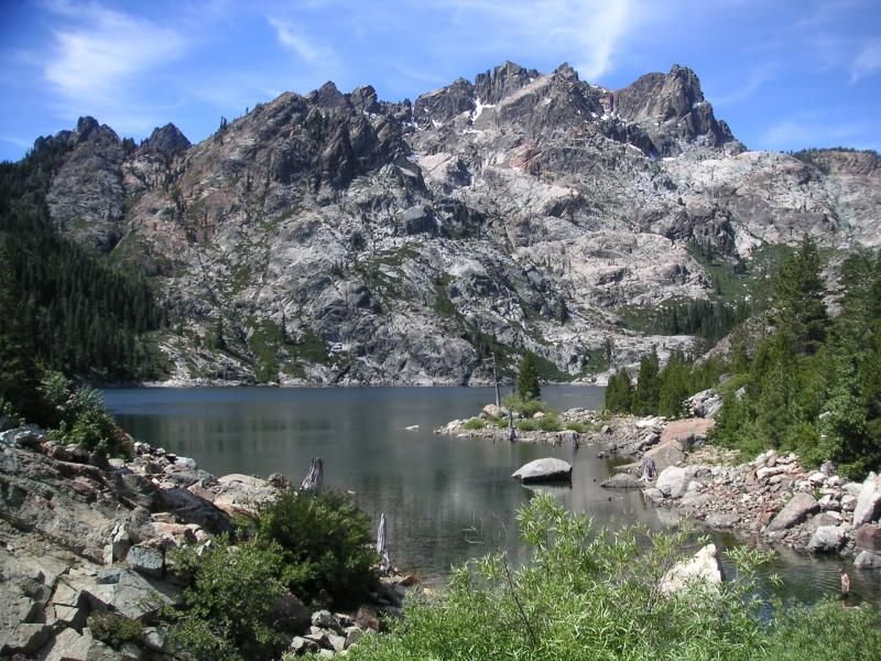
We arrived at Sardine Lake and went for a hike, because it was midmorning, after two hours behind the wheel, and a little too early for lunch. We hiked along a trail covered in cobblestone-sized rocks up to Upper Sardine Lake. It is a Cirque Lake, directly below the sheer cliffs of the Buttes, which despite being carved by glaciers have continued serious erosion since then due to being made of extremely brittle rock, some of which is marble, some greenstone, and all containing rough chunks of deep-sea chert within them. Chert only forms at least a thousand miles out to sea because it requires uncontaminated dissolved silica-rich seawater for its source. No rocks, no mud, no terrestrial surface stuff. Just deep sea water. There are mountain high cliffs of it north of San Francisco, where there's a great view. Very famous to Sedimentologists. And photographers. Some of that same chert is 250 miles away in the Sierra Buttes, at 6000 feet. And ain't that a heck of a thing?
We drove 4 hours all told. Two hours there, two hours back via 49 to 89, 89 to 80, 80 to 20 and home. Beautiful weather. Roads were good until we got to the Nevada County stretch of 89 where the road turned into superslab poorly paved with asphalt. Terrible and uncomfortable, those last 20 miles before Truckee. Summer driving in the Sierras is all about the rivers, trees, wildflowers, mountain scenery, and wild places. Having just driven those, I think my dreams of a railroad up there for tourists is a bust. It is too far, serving too few people. Too many resources for not enough payoff. All the more important to visit there while we can. Someday getting back there is going to be expensive, and the locals will have a tough time growing enough food for the winters and probably have to abandon it until such time as regular food runs are possible again. However long that may be.
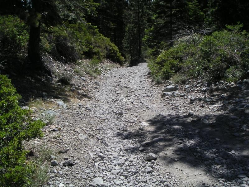
Someday many roads in the sierra will look like this. Enjoy the pavement while you can. It is not forever.
No comments:
Post a Comment