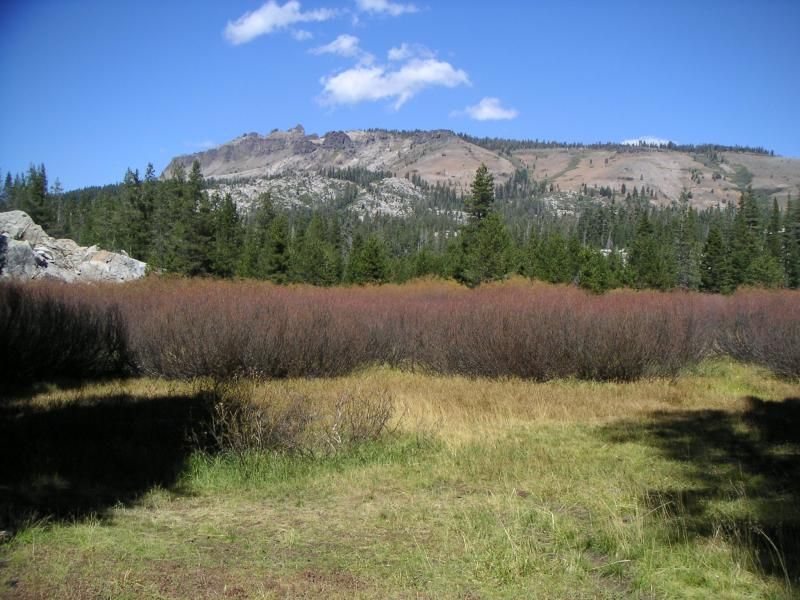
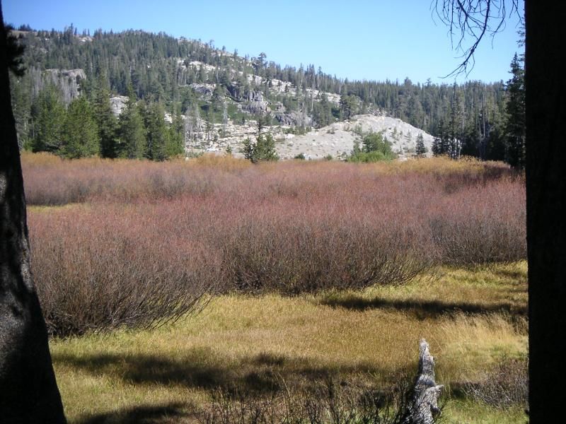
Its early Fall in the high sierras. This is a meadow on the Pacific Crest Trail. Those trees on the other side of the red bushes? I-80 isn't far beyond there. This is Donner Pass. Castle Crags are the black rocks high above. There were 40 mph gusts that day, and the high temp was mid 70's at best. The grass in the foreground is a former alpine lake that has been filled in by debris and pebbles from the granite behind me, then water-tolerant plants grew up and the meadow itself is filling in with bushes and eventually trees. In a decade, this will just be more forest. There's only really standing water here in the spring, and its not very deep and vanishes quickly. That's how meadows work. Alpine meadows end up being a place that special grasses absorb water and grow longer than they normally would. Ranchers take advantage of this by grazing their cattle on regular grass on the hillsides, then moving them into the meadows in mid-summer where its still green, but after the meadow soil has firmed up and dried out a bit. In the spring, when these meadows are flooded, bugs and frogs live in the grass and rainbow trout wriggle through a few inches of water to eat them. When they get too big, they're constrained to the stream itself, and they also get eaten by birds like egrets, hunting for frogs as well. The ecosystem does this provided erosion doesn't cut the stream too deep and drain the shallow pond that a proper meadow must maintain to support the ecosystem. There are people who fill in the erosion and slow down the drainage to restore the meadow and thus improve the grazing once more. Its not that cheap, but its not that expensive either. Most of the materials are rocks, clay, and soil.
At lunch with this view, a little ways South of our usual spot. In the other direction I had this:
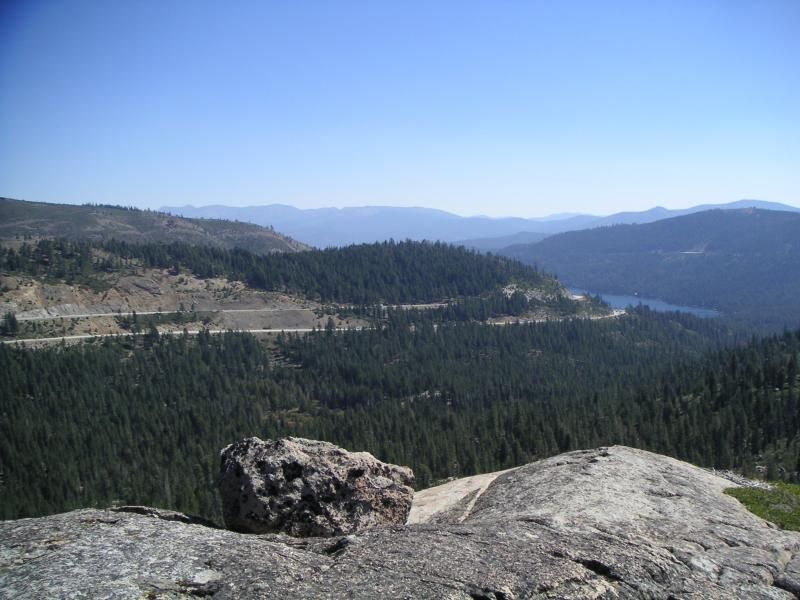
And this is what you see when you get a little closer to the edge. Donner Lake on the right side.
And yes, that's about 1000 feet down below me. No, I'm not afraid of heights. The two strips of pavement are I-80 on the Eastern Side. They're in pretty good shape right now. Not once Winter chews the heck out of it, though. Imagine pedaling up that on a touring bicycle. Ugh.
Dad on a ridge of granodiorite, complete with xenoliths.
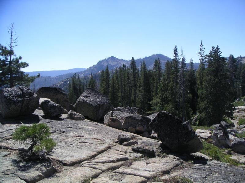
You can hear the trucks in the background, but look at this view. It looks fake. Its a real place though. Free, too. Just wear decent hiking boots because you need to clamber lots of rocks to get there, and it will be snowing in another month.
Carved by glaciers, dropstones left behind when it melted back during global warming 19,000 years ago. Al Gojira won't be reporting that. It undercuts his message of blaming humans. I wish they had more proof about the comet impact 12,000 years ago in Canada. I think its pretty weak evidence. Maybe there was a fragment and maybe that flash melted the big Canadian Ice Sheet and wiped out the megafauna in North America. Maybe. If so, we could see a return of the ice age much sooner since we're at one of those reglaciation tipping points. I wouldn't mind. These places are beautiful to me. Watching the glaciers reform and creep down the mountains? Lovely.
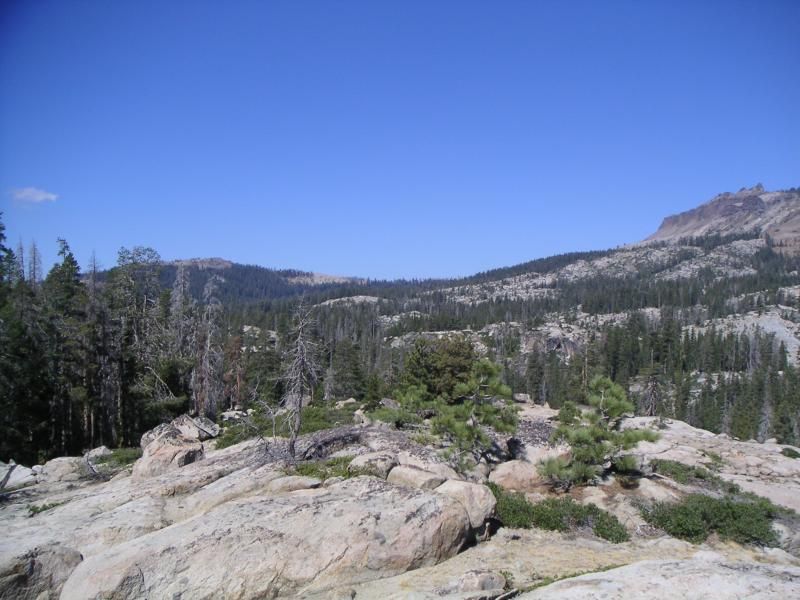
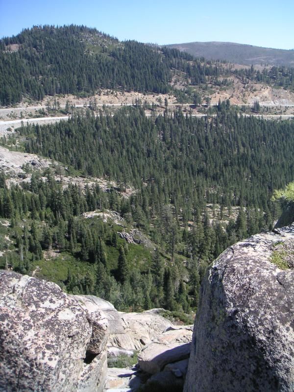
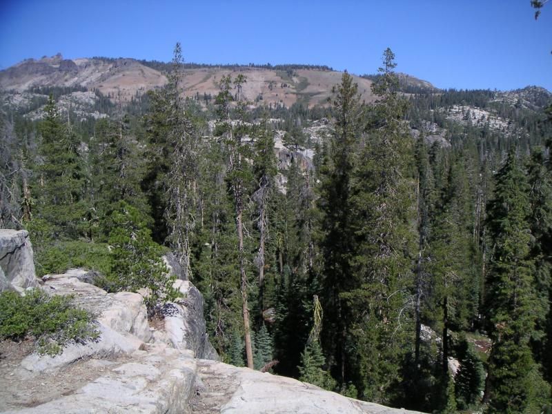
The actual pass is over there, on the left. In a low spot, obviously. The rest stop was just beyond that meadow, the actual top of the pass. You hear the traffic on the trail but the scenery is so beautiful you sort of tune it out. I suspect the big upside of them eventually legallizing marijuana is places like this won't be dangerous to hike in because there would be no point killing hikers for stumbling on a pot field. There was one discovered near Bowman Lake, beyond that distant peak on the left, a huge meadow lake, that was acres across and run by the Mexican cartel. They'd cheerfully shoot anyone who found it, which is a big bummer since a couple rock climbers are writing a book about a local cliff near the lake. Near I-40, which runs south of this spot, the old Donner Pass Road, there's a popular spot for rock climbing up this same granite, good for beginners and intermediate level, and its easy to get to so gets visitors from East and West sides of the mountain, usually a hundred people on the weekend days. Ambitious bicyclists climb the old pass road, which is about 2000 feet vertical from Donner Lake well below. Its a very hard climb and tests a person for hours, even on the lightest bikes and the greatest fitness level. The place I hiked was threatened with condos, but locals bought up the land and got it turned into a park instead, which I'm glad about. Its beautiful. Mom really liked hiking there with Dad, having lunch.
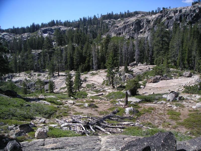
Bark beetles are killing trees, and strong winds through the pass drop them suddenly. We found several new trees down since August.
The breeze was gusting 20 mph the whole hike, btw.
In the next few weeks the alders will turn golden and it will be worth a proper drive through the high country. In another month, the Salmon will run at Travis Creek near South Lake Tahoe on the Western Shore, and thousands of people will come to see them. Smaller than you'd think, yet still salmon, there due to an accident. The Sierras are a harsh environment, but this also makes them strong and the time there precious and its moments fleeting. A place that cries out for a good camera. If you visit in coming weeks, be sure to bring yours.

No comments:
Post a Comment